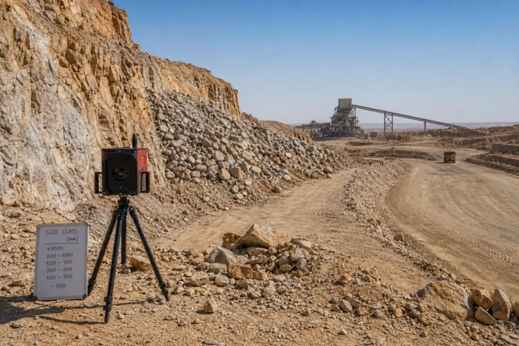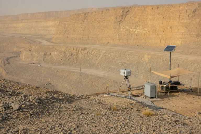
Watching pit walls is an operational discipline, not a one-time study. Slope stability in open-pit mining evolves continuously as excavation progresses and geomechanical conditions change, which is why monitoring matters as much as design. For teams working on slope stability monitoring radar mining Saudi Arabia programs, the practical question is how to turn continuous measurements into decisions that protect people, equipment, and production. Recent industry reporting describes radar-specific products that combine microwave sensing, interferometric processing, alarms, and operational software to identify millimetre- to centimetre-scale movement across a slope. In parallel, slope monitoring services are broadening into multi-sensor frameworks that aim to continuously observe and analyze deformation patterns across mining and infrastructure corridors.
Radar remains central because it can repeatedly measure a broad mine wall without placing personnel inside the exclusion zone. One market source estimates ground-based interferometric radar held the largest technology share at 48% in 2025, reflecting the operational advantage of scanning from a stand-off position. The same source frames demand growth beyond mines too, noting transport corridors, tailings facilities, and major dam projects as additional applications. At the regional level, it reports the Middle East and Africa together account for 9% of radar-specific revenue, and it names Saudi Arabia alongside the United Arab Emirates and Morocco as markets adding roads, railways, quarries, dams, and large development sites. It also flags heat, dust, limited connectivity, and specialist travel costs as reasons ruggedisation and managed monitoring can be especially relevant.
From Color Maps to Decisions: Integrating Radar, InSAR, and Stability Analysis
Value comes from interpretation, not just imagery. In an open pit, one industry source notes that a mature deployment links the deformation map to mine geometry, weather, blasting, haul-road access, and geotechnical interpretation, so a rising velocity trend on a specific bench can trigger a targeted exclusion zone rather than a blanket shutdown. A monitoring-based framework published on an open-pit copper mine demonstrates how integration can sharpen understanding: it combined ground-based radar monitoring, satellite InSAR time-series analysis, and numerical stability modeling. Radar monitoring in that study indicated deformation was concentrated within three discrete zones (Areas 1–3) rather than being uniformly distributed across the pit wall, and slope displacement and velocity were continuously monitored using ground-based radar to assess temporal deformation evolution.
Satellite InSAR adds a pit-scale layer that does not depend on ground-installed sensors and can provide displacement time series under evolving operations. A case example using a monthly Sentinel-1 analysis covered 27/08/2018 to 02/10/2018 over an open-pit slope that subsequently failed on October 13th, 2018. The analysis detected progressive displacement acceleration in the weeks leading up to the event, indicating a clear loss of stability prior to failure. Using inverse velocity analysis on the displacement time series, the predicted failure date was within approximately three days. This kind of time-series context can complement ground-based radar by helping teams distinguish localized wall responses from broader slope trends.
Procurement momentum is also being shaped by market growth, integration, and packaging with geotechnical systems. One forecast values the slope deformation monitoring radar market at $385.6 Million in 2026 and projects $865.55 Million by 2035, with a 9.40% CAGR, and it points to mining operators in Australia and Chile expanding procurement of ground-based interferometric systems for pit wall stability. A separate forecast values the global open pit wall monitoring system market at $443.1 million in 2025 and projects $973.4 million by 2034, growing at a 9.2% CAGR, and it lists slope stability safety regulations, advanced sensor technology, and real-time hazard detection as drivers. That same report references ISO 22475 series standards for geotechnical investigation and testing, including slope monitoring specifications increasingly referenced in mining permits, reinforcing why integrated radar-plus-geotechnical monitoring is becoming a default expectation rather than an optional upgrade.
Why is ground-based interferometric radar widely used for open-pit wall monitoring?
How can integrated workflows improve slope stability interpretation?
What can satellite InSAR contribute to early warning in open pits?
What does the Middle East and Africa radar monitoring share indicate for Saudi Arabia context?
How is slope stability monitoring radar used in mining in Saudi Arabia without over-shutting operations?