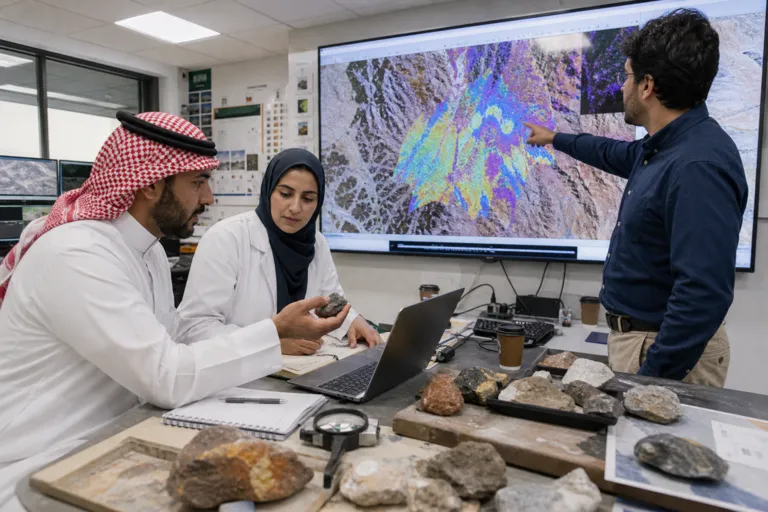
Hyperspectral imaging is gaining attention because it can detect subtle variations in surface composition. NASA links its growing use to environmental monitoring, agriculture, mineral exploration, defense, and medical diagnostics, largely because it can reveal fine differences in materials and health indicators. For Saudi Arabia, that matters because exploration often starts with wide-area screening, and satellites can extend that view beyond what field teams can cover quickly. MarketDataForecast notes that the Middle East and Africa account for a “decent portion” of the global hyperspectral imaging systems market, and it names Saudi Arabia, the UAE, and South Africa as key contributors. It also says the region lags other markets by volume, but is making gradual progress across environmental monitoring, mineral exploration, and defense applications.
This regional momentum sits inside a fast-expanding global market landscape. Mordor Intelligence projects the hyperspectral imaging market to rise from USD 259.31 million in 2025 to USD 299.81 million in 2026, and to reach USD 619.47 million by 2031, at a 15.62% CAGR over 2026–2031. Technavio separately expects the market to increase by USD 1.10 billion at a 13.3% CAGR from 2025 to 2030, and it values the military and surveillance segment at USD 296.5 million in 2024. These figures are global context, not Saudi-only numbers, but they help explain why more suppliers, tools, and workflows are becoming available to support hyperspectral satellite exploration in Saudi Arabia, especially where defense and remote sensing use cases overlap with mapping and reconnaissance.
Why Hyperspectral Satellites Speed Up Exploration Workflows
Speed gains come from combining hyperspectral sensors with modern analytics. MarketDataForecast highlights that the European Space Agency describes satellite-based hyperspectral sensors as critical for assessing climate change impacts, including tracking vegetation stress, oceanic conditions, and atmospheric pollutants with high precision. On the analytics side, the same source cites MIT Computer Science & AI Lab: deep learning models trained on hyperspectral datasets have demonstrated up to 90% accuracy in identifying crop diseases, mineral compositions, and tissue abnormalities. Mordor Intelligence adds a related signal about compute moving closer to the sensor, noting that on-chip neural networks can push inference latency below 10 milliseconds. Together, these capabilities support quicker screening, faster targeting, and fewer iterations between imagery review and field verification.
Costs and product choices also shape adoption. Mordor Intelligence reports that cameras led with a 54.32% revenue share in 2025, while pushbroom architectures accounted for 47.22% of 2025 revenue. It also notes a 35% price drop in entry-level VNIR and SWIR detector pricing between 2024 and 2025. Technavio similarly says the cameras segment held the largest market revenue share in 2024, while flagging challenges such as high upfront system costs and the complexity of processing the large hyperspectral data cube. For Saudi Arabia’s exploration teams and service providers, those global shifts matter because they influence how quickly new satellite-derived datasets can be operationalized, and whether analytics are delivered as services or kept in-house as expertise matures.
Satellite-specific investment is also expanding the ecosystem that Saudi users can tap. Dataintelo estimates the global hyperspectral imaging satellite market size reached USD 1.42 billion in 2024, with a projected 12.8% CAGR from 2025 to 2033, while its separate hyperspectral satellite report places the global market size at USD 1.26 billion in 2024. Straits Research describes commercial scale-up efforts, including Pixxel’s December 2024 funding update: an additional USD 24 million as part of its Series B round, bringing total funding to USD 95 million, intended to accelerate the development and launch of 18 commercial hyperspectral satellites. These are global and company-level signals, but they reinforce a practical takeaway for Saudi Arabia: as more hyperspectral satellites and analytics services come online, exploration programs can source more frequent observations and more specialized processing without waiting for bespoke missions.
How is hyperspectral satellite exploration evolving in Saudi Arabia?
What makes hyperspectral imagery useful for mineral exploration and mapping?
What global market signals suggest hyperspectral tools are becoming more accessible?
How does AI change hyperspectral satellite analysis speed?