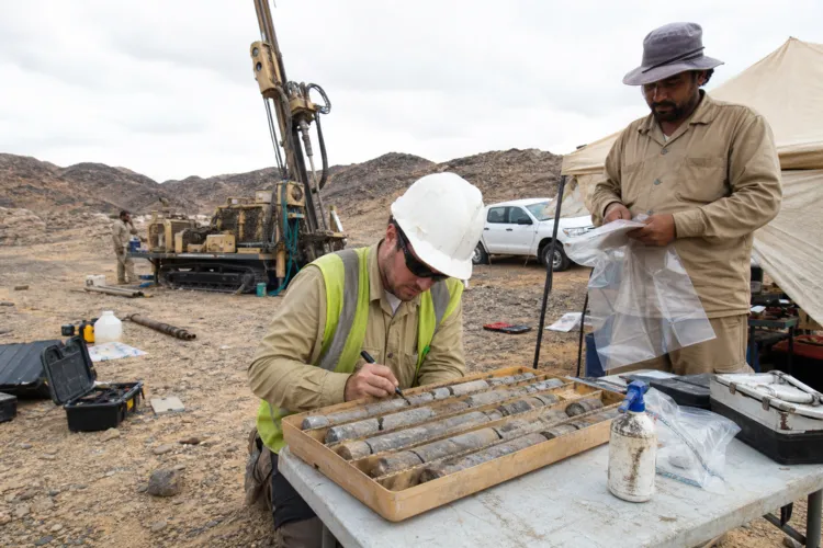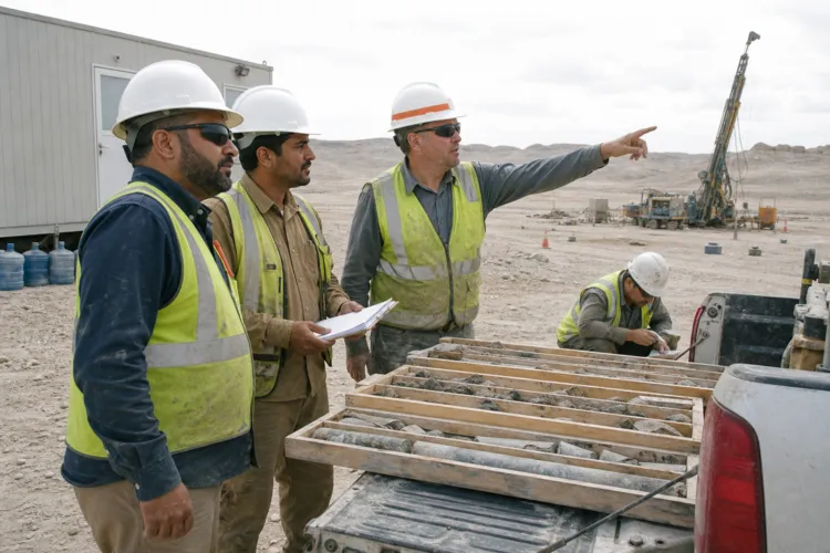
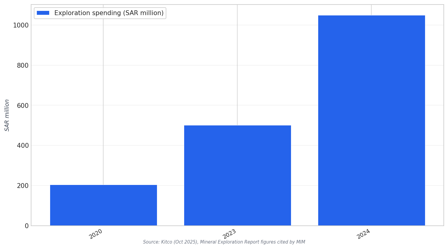
Saudi Arabia’s mineral exploration push is being driven by higher spending, tighter integration between government and private sector, and a growing reliance on digital tools. The Ministry of Industry and Mineral Resources reported exploration spending of SAR 205 million (USD 55 million) in 2020, SAR 501 million (USD 133.5 million) in 2023, and SAR 1.05 billion (USD 280.5 million) in 2024. In parallel, the Saudi Geological Survey is developing a comprehensive national geological database through the Regional Geological Survey Program and the Accelerated Exploration Program, aimed at identifying mineral potential and accelerating data collection and analysis. This context is where drone, LiDAR, and aeromagnetic surveys become foundational field-to-model inputs, not isolated datasets.
This scale-up is also visible in permits and service breadth. Estimated sector figures show exploration permits issued rising from 120 in 2024 to 145+ in 2025, alongside “major mining services” categories moving from 5 to 7 over the same period. The same table estimates investment value at $32.5 billion in 2024 and $38.3 billion in 2025. These shifts matter because drone survey mineral exploration Saudi Arabia programs typically sit inside larger operational pipelines: logistics, remote monitoring systems, and geotechnical surveys are described as part of mining services support. In other words, airborne and near-surface sensing is increasingly operationalized as a repeatable service layer.
From Airborne Signals to Connected Exploration Models
Aeromagnetic surveys show how standardized flight specifications can produce structured datasets suitable for downstream interpretation. A published aeromagnetic project example (outside Saudi Arabia) described a total magnetic intensity map generated using 120 m terrain clearance, NE–SW flight lines, 1.5 km traverse spacing, and 10 km tie-line spacing, flown with a twin engine Cessna-Titan type 404 aircraft. While that case is from Egypt, it illustrates the kind of repeatable acquisition parameters that feed modern interpretation workflows. In Saudi Arabia, the narrative is about scaling “data-driven mineral exploration,” which is why consistent airborne datasets fit naturally into national database-building efforts and accelerated analysis programs.
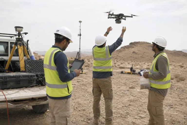
LiDAR and drone-based sensing are also being positioned as faster and safer ways to generate actionable screening insights. A drone-mobile, laser-based system called REMINLASER is described as combining drone mobility with laser-based analysis to deliver faster insights, improve safety, and support more sustainable resource use in assessing mining waste. The same report notes it builds on earlier systems like a drone-compatible, laser-based analytical platform. These developments reinforce the same direction Saudi exploration is taking: more data capture closer to the ground, and more rapid conversion of measurements into digital inputs for targeting, prioritization, and decision-making.
Saudi exploration growth is also tied to digital ecosystems and partnerships that can absorb and connect these datasets. Seequent said it would showcase geoscience technologies at the Future Minerals Forum 2026 in Riyadh, including MX Deposit, Imago, Leapfrog, Evo platform, and Oasis Montaj, describing how they work together as a connected digital ecosystem for exploration and mining. On the operator side, Ma’aden and Hancock entered a joint venture in December 2025 to accelerate exploration efforts in licensed areas, with Ma’aden stating it has been ramping up exploration across the Kingdom. Separately, a multi-year deal described imaging Saudi Arabia’s “2.5T mineral assets” across 12,000 square kilometers of the Arabian Shield as part of an AI-powered exploration program, aligning with the push toward AI-ready exploration and orebody data.
What does “drone survey mineral exploration Saudi Arabia” mean in practice?
How fast is Saudi Arabia’s exploration spending growing?
How do aeromagnetic surveys become usable exploration inputs?
What digital tools are being positioned for exploration in Saudi Arabia?
Which Saudi exploration partnerships signal acceleration?